Have you ever wondered how to access maps of aquifers in your region? Understanding where these underground water reservoirs are located can be crucial for various reasons, including water conservation, gardening, farming, and even planning construction projects. While the process might seem complex at first glance, with the right guidance, you’ll find it’s not too difficult to obtain the information you need.
Understanding Aquifers
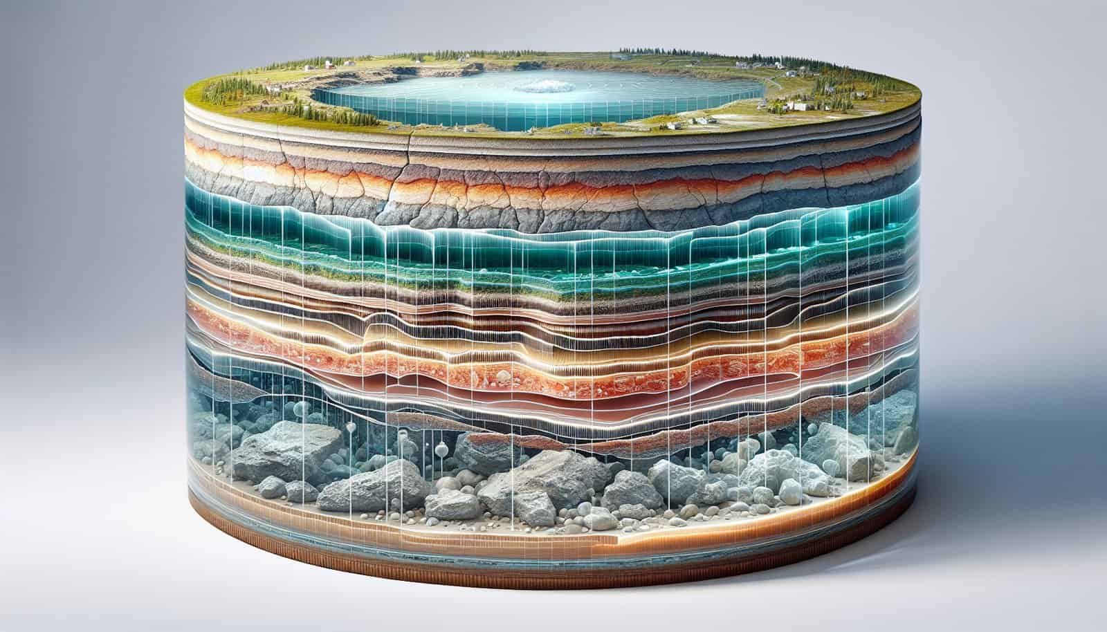
Aquifers are underground layers of water-bearing rock or materials (like gravel, sand, or silt) that can store and transmit significant amounts of water. These natural reservoirs are vital resources for drinking water, agriculture, and industry. But why are they important, and how can you access maps of these valuable sources?
What Makes Aquifers Valuable?
Aquifers play a crucial role in supplying water to wells and springs. They are often replenished by rainfall and surface water, making them an essential part of the hydrological cycle. The availability of aquifer maps can help you understand the groundwater resources in your area, which can be particularly valuable in drought-prone regions or for planning the sustainable use of water resources.
Types of Aquifers
There are several types of aquifers, each with distinct characteristics:
- Unconfined Aquifers: These are aquifers where water seeps from the ground surface directly to the aquifer. They are usually made of porous materials like sand and gravel.
- Confined Aquifers: These are bounded above and below by layers of less permeable rock or clay, which impedes water flow. These aquifers can create artesian wells, where water flows to the surface without pumping.
- Perched Aquifers: These occur when a localized layer of impermeable material holds water above the main water table.
Understanding the type of aquifer can help determine the method of extraction and usage of the water.
Why Access Maps of Aquifers?
Before considering how to access aquifer maps, it’s crucial to understand why these maps are valuable. Here are a few key reasons:
Sustainable Water Management
Aquifer maps allow for the analysis of groundwater levels, which is critical for sustainable water management. By knowing where aquifers are located, you can better plan for efficient water usage, especially in areas with limited surface water resources.
Agricultural and Industrial Planning
For farmers and industries, accessing aquifer maps is essential to ensure that there is a reliable water source for irrigation and industrial processes. This can help optimize water usage and reduce the impact on local water resources.
Environmental Conservation
Aquifer maps can aid in the conservation of ecosystems that depend on groundwater. Understanding the geographical extent and health of aquifers helps in making informed decisions about land use and protecting underground water resources from pollution or over-extraction.
Policy Making and Research
Policy makers and researchers rely on accurate aquifer data to make informed decisions regarding water resource management, urban planning, and environmental protection. Having access to detailed maps helps in crafting policies that consider long-term sustainability.

Where to Find Aquifer Maps
Finding aquifer maps might initially seem like a daunting task, but several resources can help you access this information efficiently.
Government and Public Resources
Government agencies often provide aquifer maps as part of their commitment to public service and transparency.
- United States Geological Survey (USGS): The USGS provides a wealth of information about aquifers, including downloadable maps and data sets for different regions.
- State Geological Surveys: Most states have geological surveys that offer groundwater resource maps specific to their area. They are valuable sources for regional and local data.
- Environmental Protection Agencies: In some countries, environmental agencies provide aquifer information as part of broader water resource management tools.
Online Databases and Portals
- National Ground Water Association (NGWA): The NGWA offers a variety of resources, including maps and studies on groundwater availability.
- Groundwater Monitoring Systems: Countries with organized water resource management systems often have digital portals where you can access groundwater maps and data.
Academic and Research Institutions
Universities and research institutions often conduct studies on groundwater resources and may publish their findings, including maps, for public use.
- University Libraries and Archives: These can be rich sources of historical and current aquifer maps and related research.
- Collaborative Research Projects: Institutions sometimes collaborate on projects that make aquifer data publicly available.
Private Sector and NGOs
Non-profit organizations and private companies focused on environmental conservation or geospatial data can also be sources of aquifer maps.
- Environmental NGOs: Some NGOs publish studies and maps as part of their work in environmental conservation.
- Geospatial Data Companies: These organizations may offer aquifer maps as part of broader geographical data services.
Using Aquifer Maps
Once you have acquired aquifer maps, knowing how to use them effectively is essential. Here’s how you can make the most out of these resources.
Interpreting Aquifer Maps
Aquifer maps can be complex, displaying various data forms such as depth, water quality, and recharge rates. Here’s how to interpret some key features:
- Color Codes and Symbols: Different colors and symbols represent different types of aquifers, water quality zones, and other attributes. A legend can help you understand these markers.
- Contour Lines: These indicate water levels and pressure. Close contours can signal rapid changes in water depth over a short distance.
- Scale and Orientation: Understand the scale to measure distances effectively, and note the map’s orientation (usually marked with a compass rose) to find specific geographic features.
Applying the Information
Once interpreted, aquifer maps can be applied in several practical ways:
- Drilling and Construction: Use maps to determine the best locations for drilling wells or planning construction projects.
- Water Conservation Efforts: Inform practices that enhance water conservation, such as determining suitable locations for rainwater harvesting.
- Research and Development Initiatives: Use maps for academic research or to develop technologies that rely on groundwater.
Limitations and Considerations
While aquifer maps are invaluable, they have limitations. They are typically based on available data and may not reflect real-time conditions. Here are some considerations:
- Data Accuracy and Updates: Some maps may be outdated. Always verify the publication date and consider cross-referencing multiple sources.
- Scale Limitations: Regional maps may not provide detailed data for local areas. For detailed planning, you might need more specific surveys.
- Environmental Changes: Factors like climate change can alter aquifer conditions, affecting their accuracy and requiring periodic updates.

Challenges in Accessing Aquifer Maps
Despite their benefits, there are several challenges associated with accessing aquifer maps:
Availability of Data
In some regions, especially in developing countries, the lack of comprehensive data can make it difficult to create accurate maps. Public access to existing data may also be limited due to governmental or bureaucratic constraints.
Technical Expertise Required
Reading and understanding technical hydrogeological information can be challenging for non-experts. There may be a steep learning curve for those without a background in geology or environmental science.
Costs and Accessibility
Some resources, particularly those offered by private companies, might require payment for access. Additionally, online databases may not be accessible to everyone, especially in areas with limited internet infrastructure.
Contacting Local Experts
If you encounter challenges in accessing or interpreting aquifer maps, reaching out to local experts can be invaluable.
Consult with Geologists
Geologists or hydrologists specialize in the study of the Earth’s structure, including its water resources. They can provide insights or assist you in accurately interpreting aquifer data.
Engage with Environmental Engineers
Environmental engineers often work with hydrogeological data for construction projects and water resource management. They can offer practical advice on using aquifer maps effectively.
Visit Local Water Management Agencies
Government water management agencies can provide both maps and additional resources or guidance. They may also organize workshops or seminars on water conservation and resource management where you can gain further insights.

Future Trends in Aquifer Mapping
The field of aquifer mapping is continually evolving, with several exciting trends that may improve the availability and accessibility of aquifer data in the future.
Advances in Technology
Technological advancements such as remote sensing, GIS (Geographic Information Systems), and machine learning are enhancing the accuracy and detail of aquifer maps. These technologies allow for more precise data collection over larger areas.
Community Participation Initiatives
In some regions, community mapping initiatives are involving local populations in the collection and monitoring of water data. This approach not only empowers communities but also enriches the data with local knowledge.
Improved Data Sharing Platforms
With the rise of open data platforms, it is becoming easier to share aquifer maps and related data globally. These platforms promote transparency and collaborative problem-solving in managing water resources.
Taking Action with Aquifer Maps
Harnessing the power of aquifer maps can be a transformative step in managing water resources more sustainably. Here are a few actionable ways you can start making a difference:
Advocate for Better Access
Engage with local government representatives or environmental groups to advocate for improved access to aquifer data. Encourage the implementation of policies that promote transparency and availability of environmental information.
Educate Your Community
Share your knowledge about aquifers and the importance of groundwater management with friends, family, and community members. Organize educational sessions or workshops that emphasize practical solutions for conserving water resources.
Implement Water-Saving Techniques
Use aquifer maps to identify optimal areas for water-saving techniques such as rainwater harvesting or xeriscaping (landscaping designed to reduce or eliminate the need for irrigation).
Support Research and Innovation
Consider supporting local or global research initiatives focused on water resource management and aquifer mapping. Collaborative efforts can drive innovation and lead to effective solutions for sustainable water usage.

Conclusion
Accessing maps of aquifers in your region is a vital step towards understanding and sustainably managing your water resources. Whether for personal, agricultural, or industrial use, knowing where these underground water sources lie can inform better decision-making and promote environmental conservation.
While there may be challenges in obtaining and interpreting these maps, numerous resources are available to guide you through the process. By leveraging government databases, engaging with local experts, and utilizing cutting-edge technology, you can effectively access and use aquifer maps to make a positive environmental impact.
In embracing these tools and resources, you join a growing global effort to safeguard our precious groundwater resources for future generations to come.
